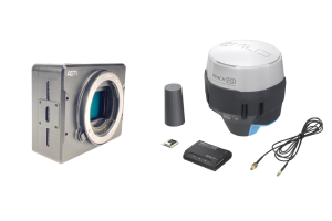
SIRIN Surveyor PPK
- SIRIN Surveyor PPK
- L1/L2 GNSS Base and
- Air Unit PPK 36MP Full Frame Camera

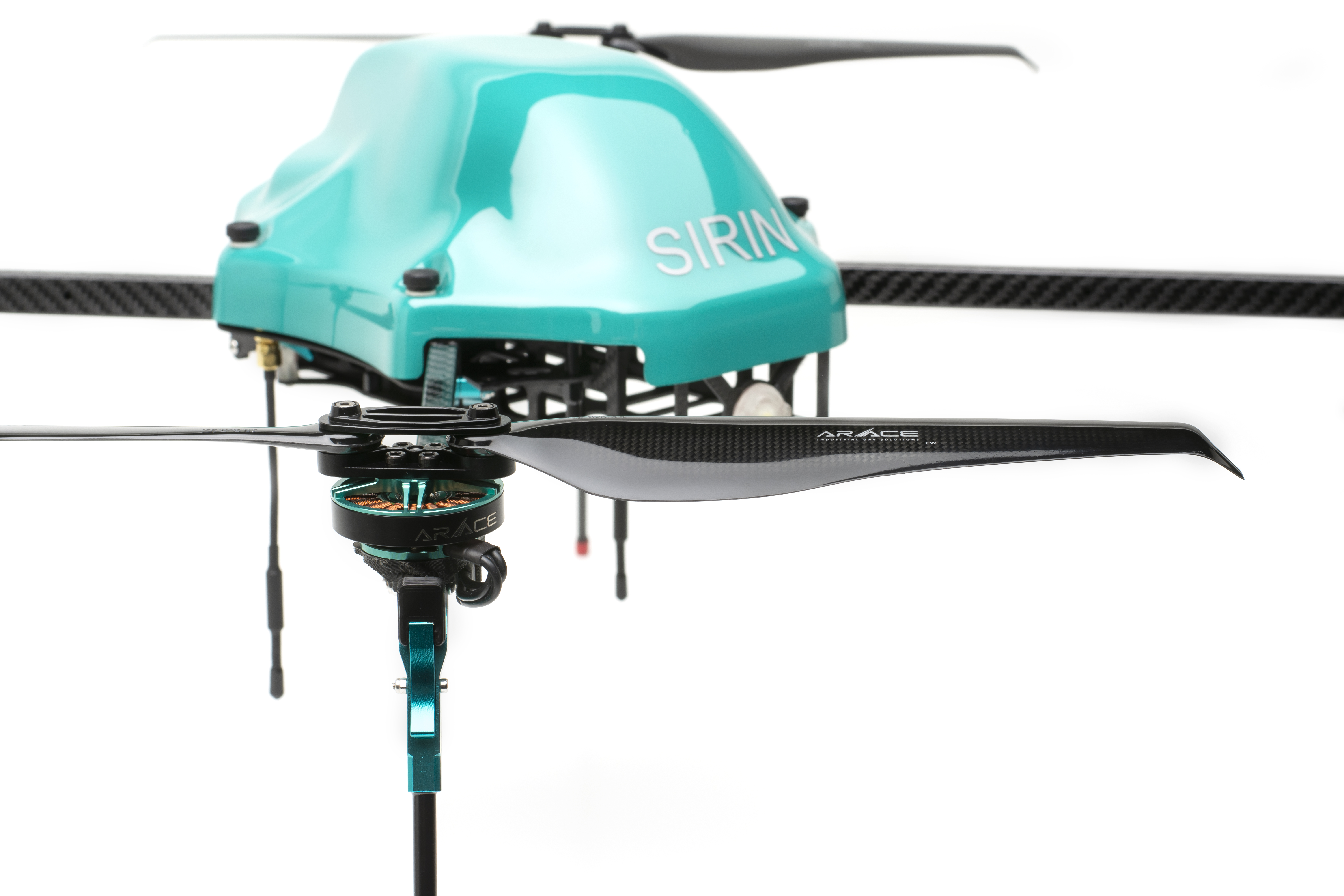
SIRIN – SAR and Security
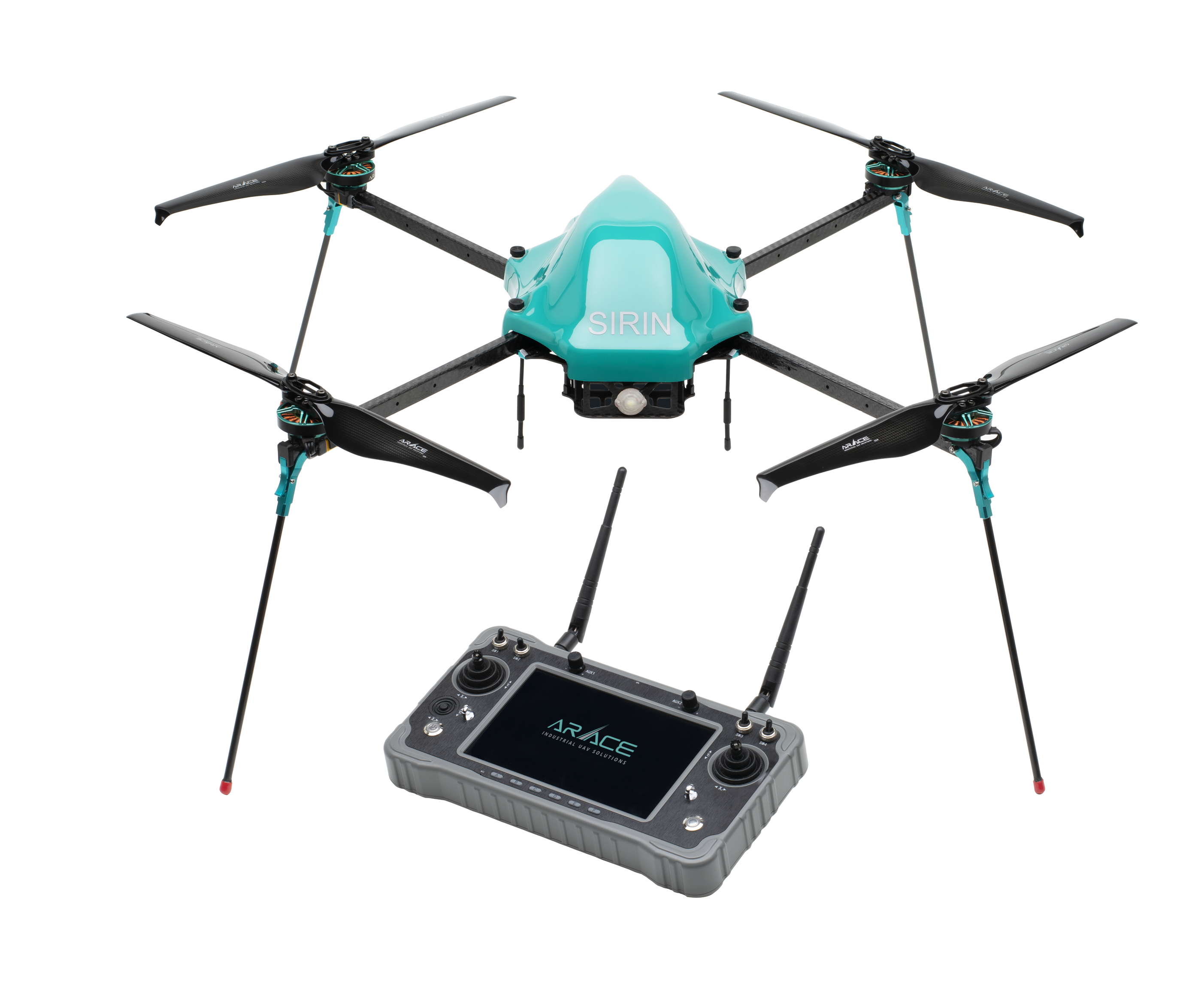
- SIRIN Dragon Eye
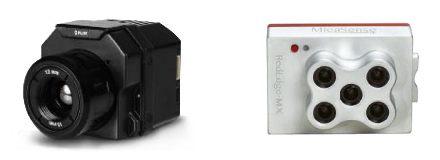
- 19mm FLIR Thermal Sensor
- 20x Zoom Daylight Sensor
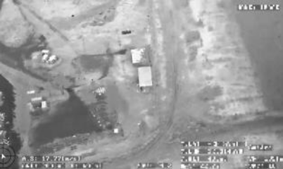
- Target Tracking, Stabilization, and Geo-Location
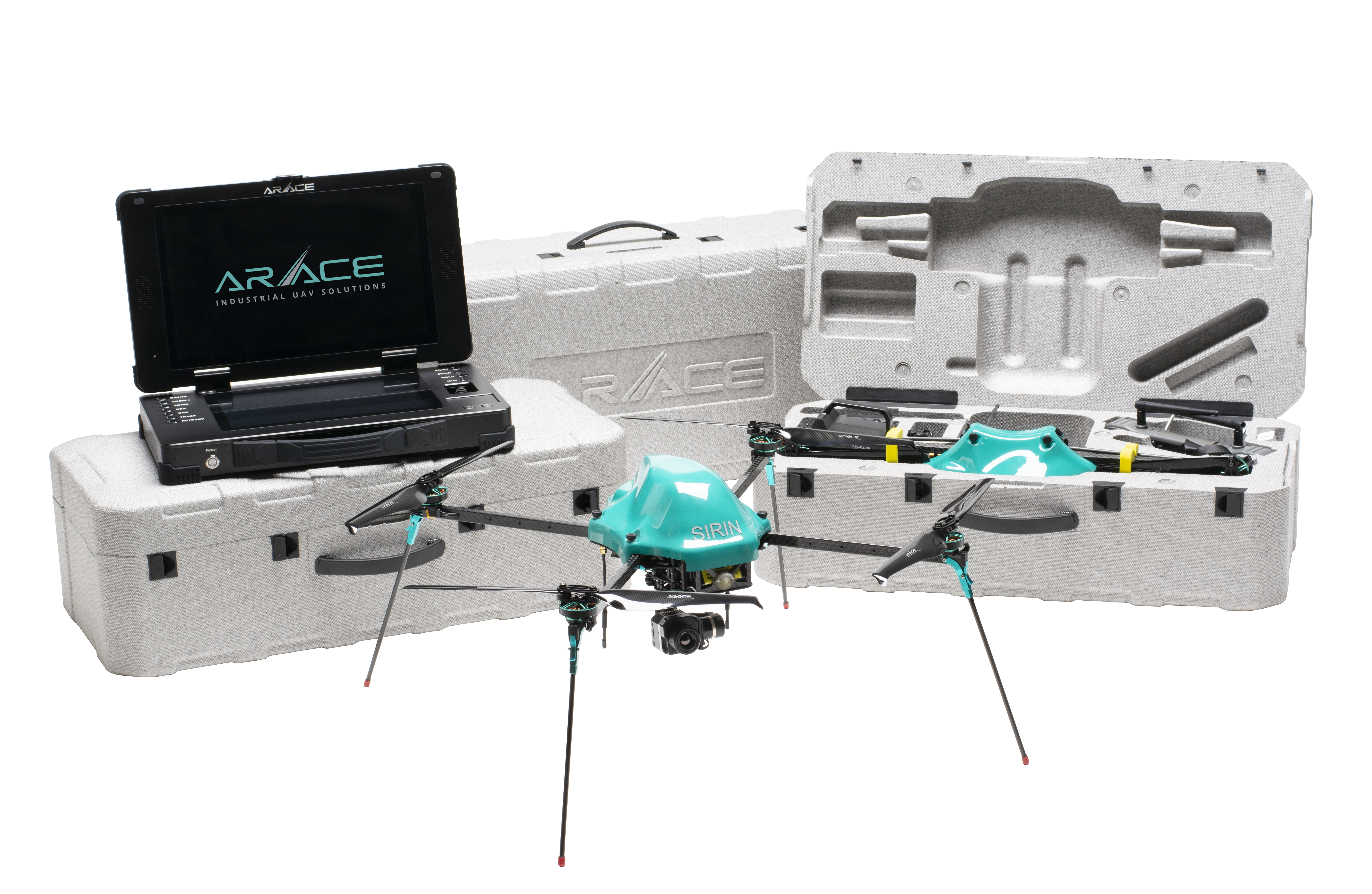
SIRIN – Command Center Edition
- SIRIN Dragon Eye Command Center Edition 19mm FLIR Thermal Sensor
- S20x Zoom Daylight Sensor
- STarget Tracking, Stabilization, and Geo-Location Secure Transparent Multipoint IP Link Additional Ground Control Station
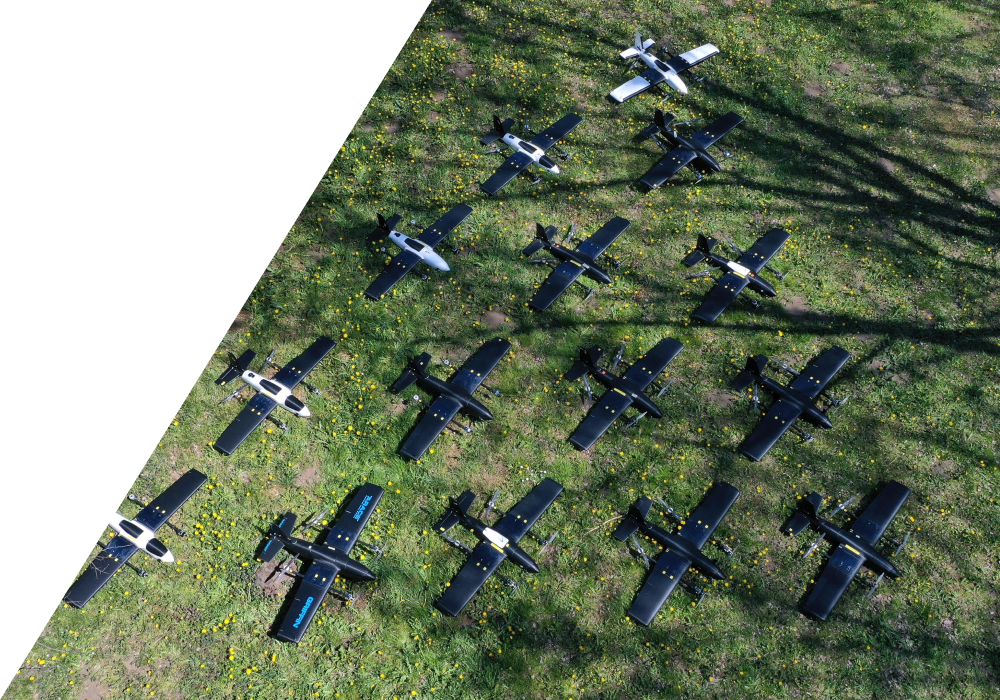
GRIFFIN VTOL PHOTOMAPPER
DUAS ARACE VTOL PHOTOMAPPER - Fully Autonomous Operation
- 1.9m wingspan
- 8 kg flying weight
- 120 minutes flying time
- 100 km linear range at zero wind
- 25 km operating radius
- Equipped with Survey Camera & L1/L2 GNSS
- Custom Mount with automatic GPS Trigger
- Equipped with fail safe protocols for low voltage, disconnections, and high wind detection
GRIFFIN VTOL MONITOR
DUAS ARACE VTOL MONITOR

- SFully Autonomous Operation
- S1.9m wingspan
- S8.5 kg flying weight
- S100 minutes flying time
- S120 km linear range at zero wind
- S25 km operating radius
- SEquipped with Israeli Mil-Spec Day/Night Sensors, 20x zoom, Auto Tracking, Geo Location, and Image Stabilization
- SEquipped with fail safe protocols for low voltage, disconnections, and high wind detection
- SSunlight Readable Dual Screen Large Monitors
- SMission planning Computer
- SFully integrated controls
- SMobile Tablet for Ground Troop Viewing and Reference

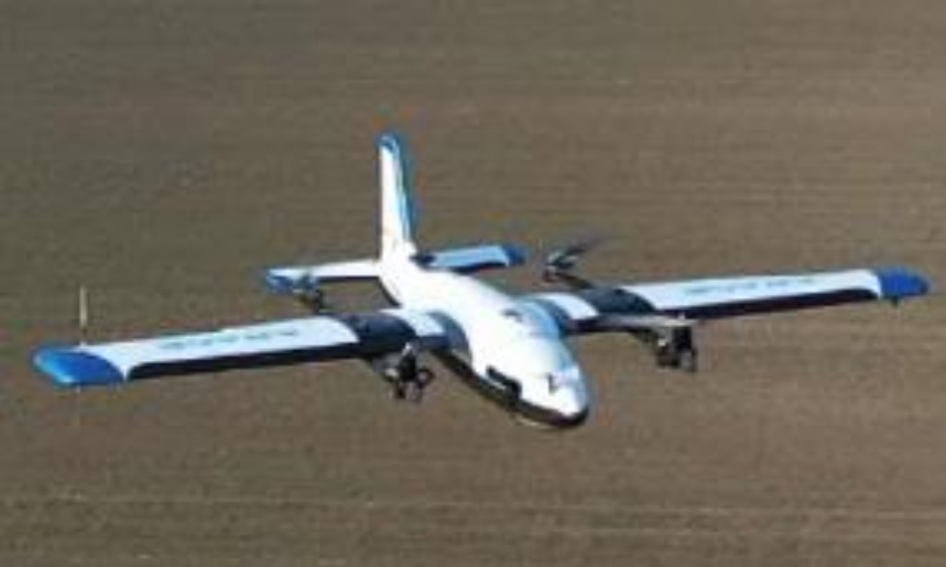
ROC CARBON VTOL ISR

DUAS ARACE ENDURANCE VTOL
- Material:Carbonfibercomposite
- Wingspan:2.5m
- MaximumOperatingAltitude:4,000mAGL
- WindResistanceatflightaltitude:Cat.6
- CruiseSpeed:19-22m/s
- Topspeed:32m/s
- Maxpayload:2.5kg
- MTOW:13.5kg
- MaximumOperatingTemperature:50DegreesCelsius • Landingandtakeoff:VTOL
- Flighttime(onasinglebattery):upto3.5hours
- Bidirectionaltelemetryrange:over50km
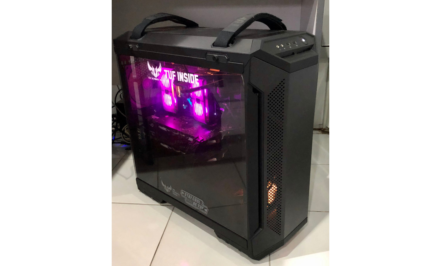
GIS PROCESSING WORKSTATION
DUAS GIS PROCESSING WORKSTATION (OPTIONAL)
- Intel 10 core, liquid cooled processor
- Dual 3080 GPU or its equivalent, 128GB DDR4 RAM
- SSD OS; 4TB HDD, 850 watts power supply
- 2KVA UPS, Monitor, Keyboard, and Mouse
- Licensed Windows 10; Agisoft Metashape